Property Record Page (Images)
printed 2/2/2025 (page 6 of 6)
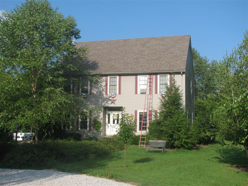
Picture 1
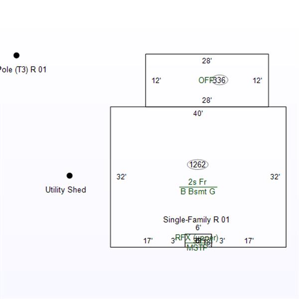
Sketch 1
printed 2/2/2025 (page 1 of 6)
| OwnerName | Hestand, David L & Tammy R |
|---|---|
| StateParcelNumber | 28-09-07-000-006.001-024 |
| ParcelNumber | 28-09-07-000-006.001-024 |
| MapNumber | 280907000006001024 |
| RoutingNumber | 0.000 |
| LegalDescription | 024-01823-00 PT NW 7 7 4 8.489A |
| Acreage | 8.4890 |
| LocationAddress | CORWIN RD BLOOMFIELD,IN 47424-0000 |
| OwnerAddress | 2799 N Corwin Rd BLOOMFIELD,IN 47424 |
| DeedBook | 33 |
| DeedPage | 1216 |
| Document |
printed 2/2/2025 (page 2 of 6)
| TaxYear | Land | Impr | Total |
|---|---|---|---|
| 2023 PAY 2024 | 21200 | 135800 | 157000 |
| 2022 PAY 2023 | 20500 | 139000 | 159500 |
| 2021 PAY 2022 | 20200 | 126100 | 146300 |
| 2020 PAY 2021 | 20100 | 126100 | 146200 |
printed 2/2/2025 (page 3 of 6)
| Tax Year | Type | Amount |
|---|---|---|
| 2024 PAY 2025 | ||
| Standard Homestead | 48000 | |
| Supplemental Homestead | 40200 | |
| 2023 PAY 2024 | ||
| Standard Homestead | 48000 | |
| Supplemental Homestead | 42320 | |
| 2022 PAY 2023 | ||
| Mortgage | 3000 | |
| Standard Homestead | 45000 | |
| Supplemental Homestead | 39200 | |
| 2021 PAY 2022 | ||
| Mortgage | 3000 | |
| Standard Homestead | 45000 | |
| Supplemental Homestead | 34685 | |
| 2020 PAY 2021 | ||
| Mortgage | 3000 | |
| Standard Homestead | 45000 | |
| Supplemental Homestead | 34685 | |
printed 2/2/2025 (page 4 of 6)
| Tax Year | Spring | Fall | Due |
|---|---|---|---|
| 2023 PAY 2024 | |||
| 650.86 | 650.86 | 0 | |
| 2022 PAY 2023 | |||
| 689.96 | 689.96 | 0 | |
| 2021 PAY 2022 | |||
| 663.37 | 663.37 | 0 | |
| 2020 PAY 2021 | |||
| 612.98 | 612.98 | 0 | |
printed 2/2/2025 (page 5 of 6)
| Tax Year | As Of | # | Amount |
|---|---|---|---|
| 2023 PAY 2024 | |||
| 11/07/2024 | Unk | 650.86 | |
| 05/06/2024 | Unk | 650.86 | |
| 2022 PAY 2023 | |||
| 11/06/2023 | Unk | 689.96 | |
| 05/01/2023 | Unk | 689.96 | |
| 2021 PAY 2022 | |||
| 10/27/2022 | Unk | 663.37 | |
| 05/02/2022 | Unk | 663.37 | |
| 2020 PAY 2021 | |||
| 10/26/2021 | Unk | 612.98 | |
| 04/22/2021 | Unk | 612.98 | |
printed 2/2/2025 (page 6 of 6)