Property Record Page (Images)
printed 4/4/2026 (page 6 of 6)
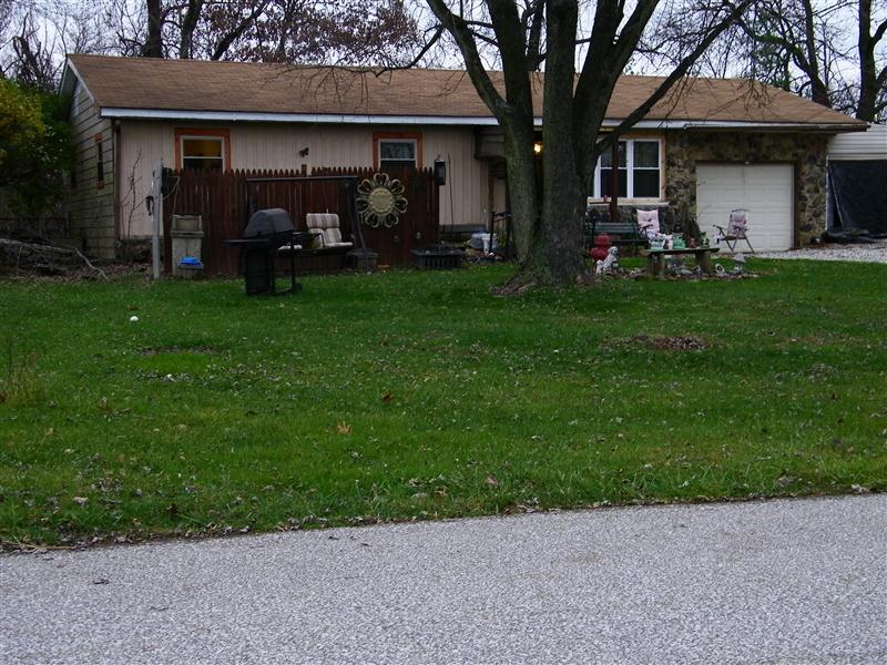
Picture 1
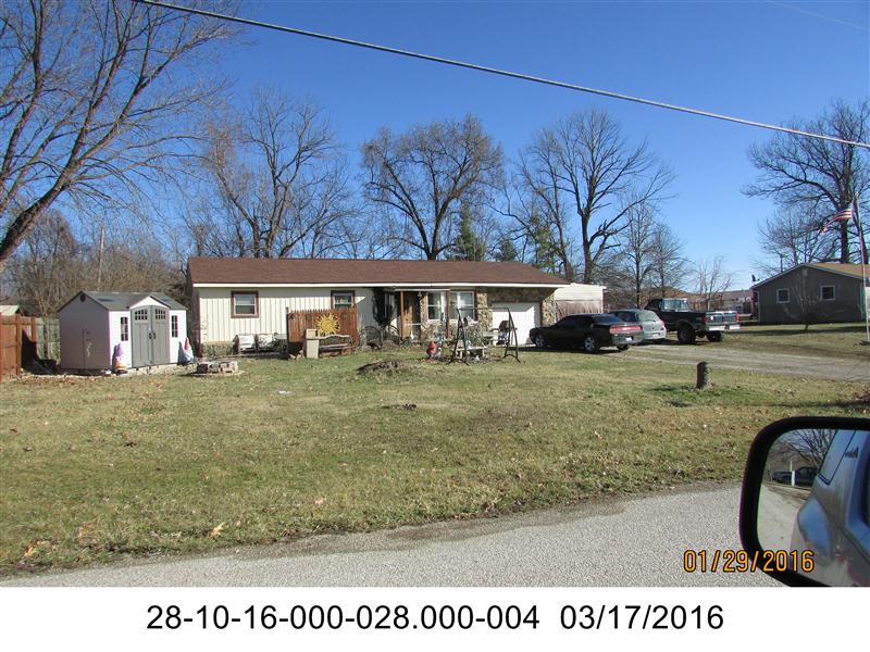
Picture 2
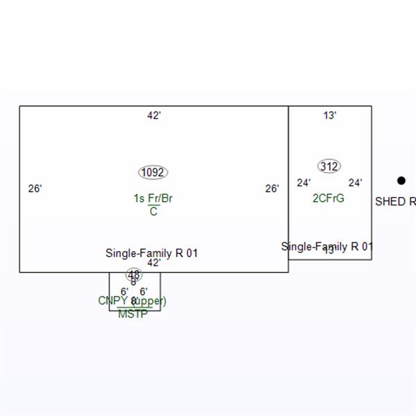
Sketch 1
printed 4/4/2026 (page 1 of 6)
| OwnerName | Meek, Bobby R. Jr. & Lisa G. |
|---|---|
| StateParcelNumber | 28-10-16-000-028.000-004 |
| ParcelNumber | 28-10-16-000-028.000-004 |
| MapNumber | |
| RoutingNumber | 0.000 |
| LegalDescription | 004-01130-00 PT SE NW 16 7 3 .40A |
| Acreage | 0.4000 |
| LocationAddress | 1560 N EASTERN LANE BLOOMFIELD,IN 47424-0000 |
| OwnerAddress | 1560 N Eastern Ln Bloomfield,IN 47424 |
| DeedBook | |
| DeedPage | |
| Document |
printed 4/4/2026 (page 2 of 6)
| TaxYear | Land | Impr | Total |
|---|---|---|---|
| 2024 PAY 2025 | 13200 | 67200 | 80400 |
| 2023 PAY 2024 | 13200 | 72000 | 85200 |
| 2022 PAY 2023 | 13200 | 74300 | 87500 |
| 2021 PAY 2022 | 13200 | 66700 | 79900 |
| 2020 PAY 2021 | 13200 | 66700 | 79900 |
printed 4/4/2026 (page 3 of 6)
| Tax Year | Type | Amount |
|---|---|---|
| 2025 PAY 2026 | ||
| Disabled | 0 | |
| Standard Homestead | 48000 | |
| Supplemental Homestead | 20840 | |
| 2024 PAY 2025 | ||
| Disabled | 12480 | |
| Standard Homestead | 48000 | |
| Supplemental Homestead | 12150 | |
| 2023 PAY 2024 | ||
| Disabled | 12480 | |
| Standard Homestead | 48000 | |
| Supplemental Homestead | 14880 | |
| 2022 PAY 2023 | ||
| Disabled | 12480 | |
| Mortgage | 3000 | |
| Standard Homestead | 45000 | |
| Supplemental Homestead | 14770 | |
| 2021 PAY 2022 | ||
| Disabled | 12480 | |
| Mortgage | 3000 | |
| Standard Homestead | 45000 | |
| Supplemental Homestead | 12110 | |
| 2020 PAY 2021 | ||
| Disabled | 12480 | |
| Mortgage | 3000 | |
| Standard Homestead | 45000 | |
| Supplemental Homestead | 12110 | |
printed 4/4/2026 (page 4 of 6)
| Tax Year | Spring | Fall | Due |
|---|---|---|---|
| 2024 PAY 2025 | |||
| 729.26 | 93.84 | 0 | |
| 2023 PAY 2024 | |||
| 514.14 | 127.84 | 455.26 | |
| 2022 PAY 2023 | |||
| 174.72 | 174.72 | 337.44 | |
| 2021 PAY 2022 | |||
| 102.78 | 102.78 | 0 | |
| 2020 PAY 2021 | |||
| 99.37 | 99.37 | 0 | |
printed 4/4/2026 (page 5 of 6)
| Tax Year | As Of | # | Amount |
|---|---|---|---|
| 2024 PAY 2025 | |||
| 10/09/2025 | Unk | 189.8 | |
| 09/25/2025 | Unk | 100 | |
| 09/22/2025 | Unk | 100 | |
| 09/15/2025 | Unk | 40 | |
| 08/15/2025 | Unk | 138.3 | |
| 08/08/2025 | Unk | 200 | |
| 03/31/2025 | Unk | 55 | |
| 2023 PAY 2024 | |||
| 02/29/2024 | Unk | 168.72 | |
| 2021 PAY 2022 | |||
| 05/10/2022 | Unk | 205.56 | |
| 2020 PAY 2021 | |||
| 05/10/2021 | Unk | 198.74 | |
printed 4/4/2026 (page 6 of 6)