Property Record Page (Images)
printed 4/27/2026 (page 6 of 6)
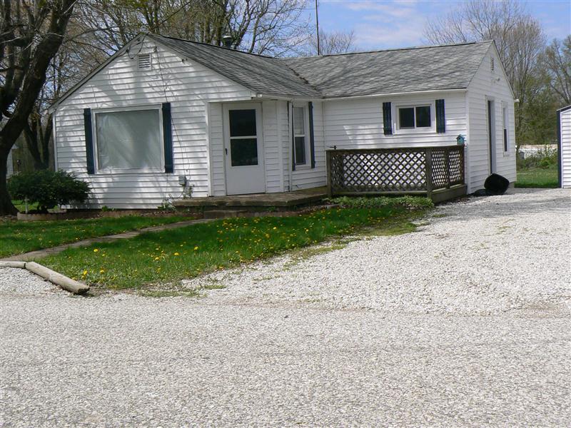
Picture 1
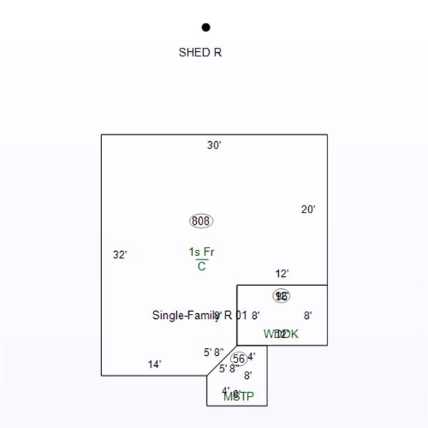
Sketch 1
printed 4/27/2026 (page 1 of 6)
| OwnerName | Corbin, Christopher & Amie |
|---|---|
| StateParcelNumber | 28-06-19-000-030.000-017 |
| ParcelNumber | 28-06-19-000-030.000-017 |
| MapNumber | |
| RoutingNumber | 0.000 |
| LegalDescription | 017-00473-00 PT SE NE 19 7 7 (83 X 60) |
| Acreage | 0.1100 |
| LocationAddress | 541 N 1500 W LINTON,IN 47441-0000 |
| OwnerAddress | 579 N 1500W LINTON,IN 47441 |
| DeedBook | |
| DeedPage | |
| Document | 2018/3612 |
printed 4/27/2026 (page 2 of 6)
| TaxYear | Land | Impr | Total |
|---|---|---|---|
| 2024 PAY 2025 | 4400 | 21900 | 26300 |
| 2023 PAY 2024 | 4400 | 21600 | 26000 |
| 2022 PAY 2023 | 4400 | 22300 | 26700 |
| 2021 PAY 2022 | 4400 | 20600 | 25000 |
| 2020 PAY 2021 | 4400 | 21800 | 26200 |
printed 4/27/2026 (page 3 of 6)
| Tax Year | Type | Amount |
|---|---|---|
| 2025 PAY 2026 | ||
| 2% Circuit Breaker Deduction | 0 | |
printed 4/27/2026 (page 4 of 6)
| Tax Year | Spring | Fall | Due |
|---|---|---|---|
| 2024 PAY 2025 | |||
| 270.8 | 270.8 | 0 | |
| 2023 PAY 2024 | |||
| 555.84 | 267.67 | 0 | |
| 2022 PAY 2023 | |||
| 274.45 | 294.17 | 288.17 | |
| 2021 PAY 2022 | |||
| 257.89 | 257.89 | 0 | |
| 2020 PAY 2021 | |||
| 269.51 | 269.51 | 0 | |
printed 4/27/2026 (page 5 of 6)
| Tax Year | As Of | # | Amount |
|---|---|---|---|
| 2024 PAY 2025 | |||
| 11/04/2025 | Unk | 270.8 | |
| 05/07/2025 | Unk | 270.8 | |
| 2023 PAY 2024 | |||
| 11/04/2024 | Unk | 267.67 | |
| 05/15/2024 | Unk | 267.67 | |
| 11/27/2023 | Unk | 288.17 | |
| 2022 PAY 2023 | |||
| 05/08/2023 | Unk | 274.45 | |
| 2021 PAY 2022 | |||
| 05/02/2022 | Unk | 515.78 | |
| 2020 PAY 2021 | |||
| 11/05/2021 | Unk | 269.51 | |
| 05/04/2021 | Unk | 269.51 | |
printed 4/27/2026 (page 6 of 6)