Property Record Page (Images)
printed 4/27/2026 (page 6 of 6)
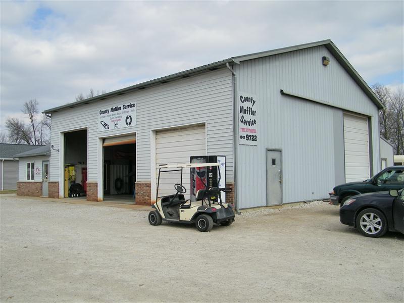
Picture 1
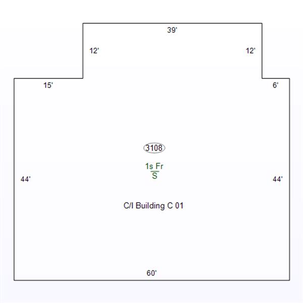
Sketch 1
printed 4/27/2026 (page 1 of 6)
| OwnerName | BLSV IV, LLC |
|---|---|
| StateParcelNumber | 28-06-22-222-042.000-018 |
| ParcelNumber | 28-06-22-222-042.000-018 |
| MapNumber | |
| RoutingNumber | |
| LegalDescription | 018-01738-00 PT NW NW 22 7 7 .3016A SURFACE ONLY |
| Acreage | 0.3016 |
| LocationAddress | NW A ST (FKA RR 2 BOX 526) LINTON,IN 47441-0000 |
| OwnerAddress | 2550 N 6th St Lot 14 TERRE HAUTE,IN 47804 |
| DeedBook | |
| DeedPage | |
| Document | 2021/0044 |
printed 4/27/2026 (page 2 of 6)
| TaxYear | Land | Impr | Total |
|---|---|---|---|
| 2024 PAY 2025 | 13800 | 41000 | 54800 |
| 2023 PAY 2024 | 13800 | 40600 | 54400 |
| 2022 PAY 2023 | 13800 | 41900 | 55700 |
| 2021 PAY 2022 | 13800 | 44900 | 58700 |
| 2020 PAY 2021 | 13800 | 44900 | 58700 |
printed 4/27/2026 (page 3 of 6)
| Tax Year | Type | Amount |
|---|
printed 4/27/2026 (page 4 of 6)
| Tax Year | Spring | Fall | Due |
|---|---|---|---|
| 2024 PAY 2025 | |||
| 916.8 | 834 | 1738.8 | |
| 2023 PAY 2024 | |||
| 822 | 822 | 0 | |
| 2022 PAY 2023 | |||
| 841.5 | 841.5 | 0 | |
| 2021 PAY 2022 | |||
| 886.5 | 886.5 | 0 | |
| 2020 PAY 2021 | |||
| 886.5 | 886.5 | 0 | |
printed 4/27/2026 (page 5 of 6)
| Tax Year | As Of | # | Amount |
|---|---|---|---|
| 2023 PAY 2024 | |||
| 11/13/2024 | Unk | 822 | |
| 05/15/2024 | Unk | 822 | |
| 2022 PAY 2023 | |||
| 11/13/2023 | Unk | 841.5 | |
| 05/10/2023 | Unk | 841.5 | |
| 2021 PAY 2022 | |||
| 11/10/2022 | Unk | 886.5 | |
| 05/05/2022 | Unk | 886.5 | |
| 2020 PAY 2021 | |||
| 11/10/2021 | Unk | 886.5 | |
| 04/27/2021 | Unk | 886.5 | |
printed 4/27/2026 (page 6 of 6)